
Summary
- Easter Island is not only known for its famous moai statues, but also for its stunning volcanic landscapes and craters.
- The island is formed by three extinct volcanoes, with Terevaka being the largest and tallest. Visitors can hike up Terevaka and see the crater and one of the island's three crater lakes.
- Easter Island also has impressive volcanic caves and lava tubes, with over 800 cataloged caves and possibly more. Exploring these caves is a unique experience for visitors.
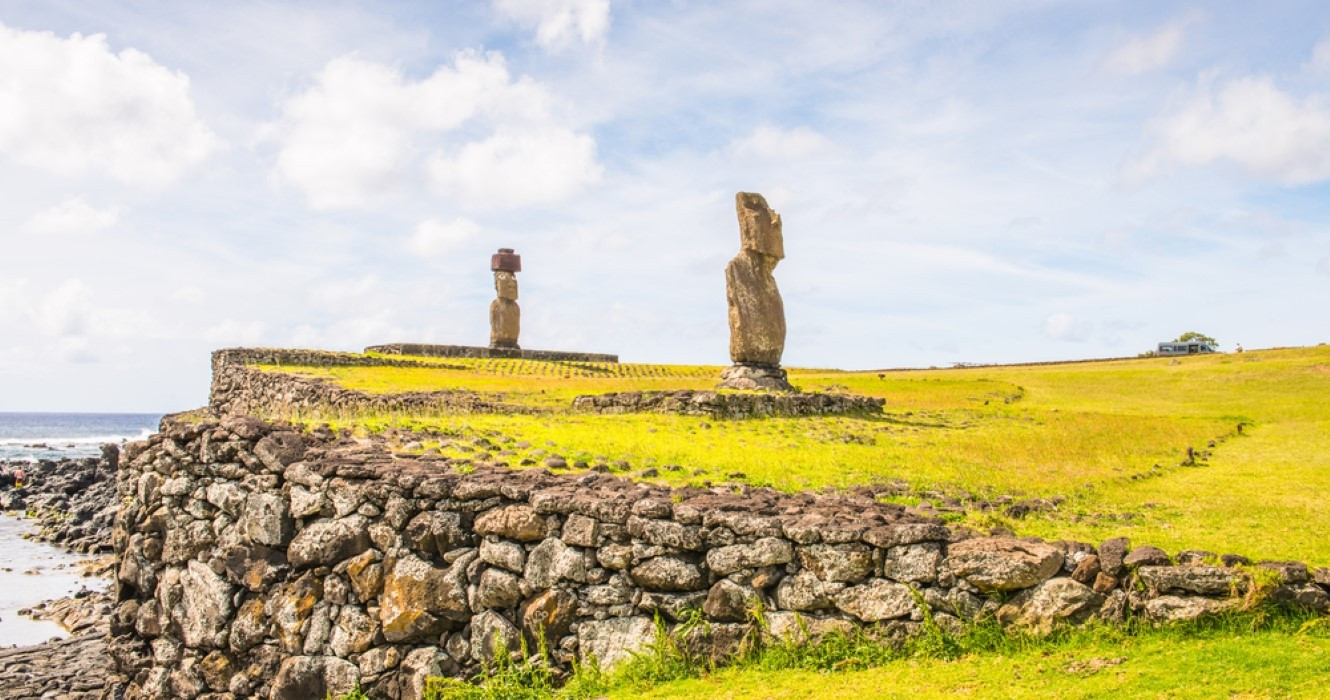
Easter Island is one of the most famous of the Polynesian islands on account of the nearly 1,000 remaining monument statues called moai (more ancient moai are being discovered all the time). While seeing the moai on Easter Island will always be the main attraction, there are plenty of other things to do on Easter Island.
Easter Island is volcanic and full of stunning landscapes and craters. There are many things to know about the Easter Island statues, but spare some time to discover the island's natural wonders as well.
What To Know About The Isolated Volcanic Easter Island

Easter Island was colonized by the Polynesian Rapa Nui people around the year 800 AD (or possibly around 1200 AD). Over time the island was deforested (it was once covered in forests). Easter Island is one of the remotest inhabited islands in the world (Pitcairn Island with a population of only 50 and the world's loneliest Airbnb is the closest at 1,300 miles away).
Chile annexed Easter Island in 1888, although it wasn't until 1966 that the Easter Islanders (or Rapa Nui) were granted Chilean citizenship. These days almost 8,000 people live on the island (around half of whom are Rapa Nui).
- Size: 15 miles long (25 kilometers) by 7.5 miles (12 kilometers) wide
- Population: 8,000 people
Easter Island has a top elevation of 507 meters or 1,663 feet above sea level. The island has three freshwater crater lakes but no permanent rivers.
Just as the Hawaiian island chain is formed from the Hawaiian Hotspot, so to Easter Island is formed by the Easter hotspot. There are dozens of seamounts in the Salas y Gomez Ridge and Easter Island. The islets, Motu Nui and Motu Iti, are just the tops of the mountains rising above sea level.
Volcanoes of Easter Island:
- Terevake
- Poike
- Rano Kau

Easter Island has been formed from three extinct volcanoes, Terevake, Poike, and Rano Kau. Terevaka is the volcano that dominates the island and makes up the bulk of the land. The smaller Poike and Rano Kau form the eastern and southern headlands of the island.
Hike Up Terevaka - The Largest Volcano On Easter Island
Terevaka (or Ma'unga Terevaka) is the largest and tallest of the three main extinct volcanoes on Easter Island. It is also the youngest of the volcanoes. There are a number of smaller volcano cones and craters found around its slopes.
- Summit: 507 meters or 1665 feet
- Duration: Approx. 4 Hours (round trip)
- Distance: 3.5 km or 2 miles (from Ahu Akivi)
Visitors can hike up Terevaka on the trail whose starting point begins by the moai at Ahu Akivi. Hike up to the crater and see Rano Aroi, one of the three crater lakes on the island. Unlike the other two volcanoes, Terevaka does not have a main crater because its historic eruptions came from a system of small volcanic centers. There are several craters near the summit.
To get to the top of Terevaka, visitors need to hike up on foot or go on horseback (mountain biking is also an option). It takes around four hours to go up to the summit and back.
While Terevaka is an obvious hiking destination, few visitors bother to climb it as most folks are only there for a couple of days and are busy seeing the archeological sites.
The Craters & Volcanic Caves Of Easter Island
The largest, most dramatic, and almost circular crater on Easter Island is in Rano Kau. Its name could be translated as "a large or wide volcano with a lot of water." Rainwater accumulates in the large caldera and forms a large lagoon measuring a mile across.
- Largest Volcanic Crater: Rano Kau
- Diameter: 1 Mile
The depth of the crater lake is around 10 meters or 33 feet and the water surface is largely covered by many floating islands of totora reeds (they are around a meter thick).
The crater is surrounded by massive walls towering over 200 meters (656 feet) high. They shield the crater from strong winds creating a natural greenhouse and microclimate.

The island has many volcanic caves and lava tubes. The lava tubes Ana Vai Teka, Ana Te Pahu, Ana Kakenga and Ana Te Pora made up one of the longest volcanic cave systems in the world.
Even though the island is small, it has underground galleries that are more than 7 kilometers or 4 miles long. There are plenty of excellent lava tubes to discover in the United States, e.g. the accessible Thurston Lava Tube on Big Island.
Over 800 caves have been cataloged on the island, but it is believed there are more than a thousand. For more information about visiting the caves, refer to Imagina Rapa Nui.